|
|
|
 |
|
|
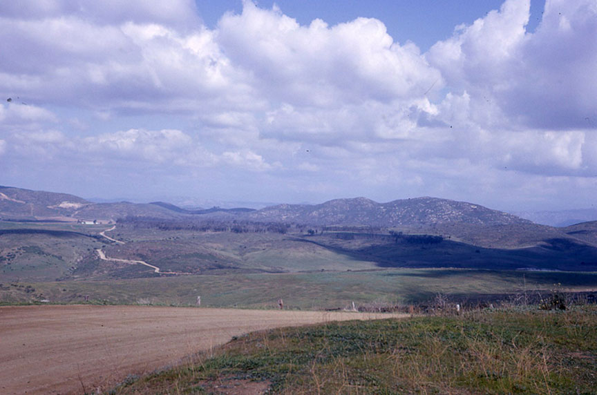
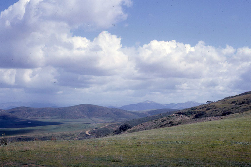
Two views of Black Mountain Road, April 1966
(Photos by Adare McAllister, courtesy of Gerry McAllister)
|
|
|
 |
|
| Here is my best guess for the two photos. I think both of them were taken from the northwest slope of Black Mountain, in what is now Peñasquitos. They are both looking northeast, toward what is now 4S Ranch. The lower photo was taken further west, from a place where hang gliders used to practice. The dirt road in the distance is where the upper photo was taken. The upper photo shows the forested area where 4S Ranch is now. I'm not sure what kind of trees they were: probably eucalyptus trees. You can see a small pond in center right. It is still there. I traveled Black Mountain Road when it was a dirt road many times, from Poway to Del Mar. We always went that way to the Del Mar Fair, until Highway 56 was built. Sometimes the rocks and washboard were terrible. If it had been raining, the clay in the road surface would get real slippery. The legend was that no tow truck would ever come to get you -- Mike Fry '60 |
|
|
 |
|
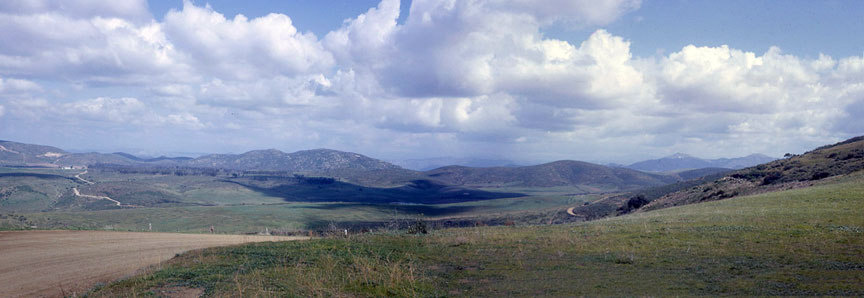
I was touched by the Black Mountain Road picture duo. When I noticed that there was actually a small overlap in the two pictures I couldn't resist manually assembling them as one panoramic shot. I filled in a little ground detail at the lower right where there was a vertical disparity. I also cleaned up some dust specks. I hope somebody can figure out just where that is now -- Owen “Wes” Western ’63
Owen Western has very sharp eyes! Yes, the photos were taken from the same spot. It is the first location I described, where hang gliders used to practice. Google Maps assigned it a postal address:
It is now part of Black Mountain Open Space Park. The actual spot was excavated to build Carmel Valley Rd, but you can still stand about 50 feet east of the photo spot. The open space to the north and east has been extensively developed as 4S Ranch. Part of the little dirt road in the left side of the panorama photo still exists. It is still called Black Mountain Road on Google Maps. It connects Camino San Bernardo with Winecreek Rd -- Mike Fry ’60
|
|
|
|
|
|
|
|
|