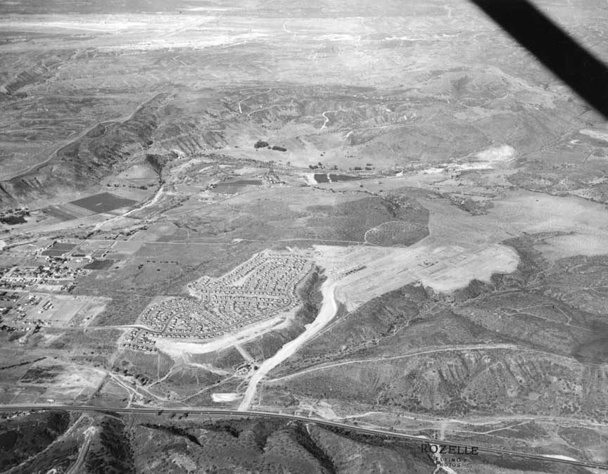
|
My
guess on aerial photo is Allied Gardens.
Newly-graded Waring Road in the middle.
College Ave under the "O" in ROZELLE.
Fairmont to Mission Gorge on the left.
Highway 80 in the foreground -- Robert
Laudy ‘73
Oooh, how I love these aerial shots. Got it!
This latest photo is looking basically north
in the San Diego area with US Highway 80
coursing through Mission Valley in the
foreground. The housing development in the
center is the first installment of Allied
Gardens, although most of Elsa Road, which
eventually would border the south end of
this part of Allied Gardens had not yet been
developed. It appears to be just a dirt
trail, as does Waring Road. Montgomery field
is at the top left -- Owen
C. Western '63
I think Howard's photo is Allied Gardens,
with Waring Road under construction. The
east-west road with the bridge is not yet US
80. I think it was called Alvarado Road back
then. You can see the ponds in the
background that are still part of the quarry
operations in Mission Gorge -- Mike
Fry ‘60
The Rozelle photos are really neat. As for
the current one: Grantville & I-8
(Alvarado Freeway) and Waring Road, looking
north -- Stan
Faulwetter ’72
I think I can shed some light on the last
aerial photos you showed on your web site
showing an overpass at the intersection of
Hwy 80 and 163 in Mission Valley. I recall
the day in 1960 when I got my driver's
license. I took my drivers test at the old
DMV downtown, where Cal Western Law School
is today. My dad gave me the car and I was
driving back to Crawford through Mission
Valley. All there was at the intersection of
Highway 163 and Highway 80 was a boulevard
stop sign. The overpass came years later.
Hope all is well and best wishes for the
holidays -- Mike
Roberts ‘62
|
|
|