|
|
|
 |
|
 |
|
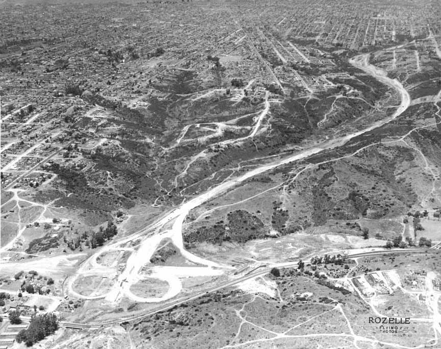
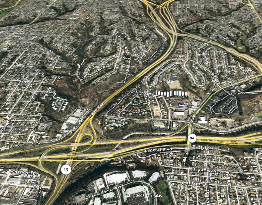
We
think the mystery picture is the intersection
of highway 94 and whatever the 15 was back
then. See the above image from Google Earth --
Alan
Fedder '69
I think the clue is the three diagonal streets
in the center of the picture. The only mesa
that was developed, was between 8 and Federal
blvd, which is maybe in the foreground. This
may be the beginning of 94 and Wabash and Home
Avenue. They worked on 94 forever. It still
wasn't done (at the west end) until after we
graduated -- Pat
Chambers ’60
To me it looks like the intersection of Rte.
94 (East & West) & 395 North (Wabash
Blvd.). Take look at the diagonal city streets
and the only place that I found that fits it
is the above area --
Eric Sarkela
What
a great puzzle! The best clue is Boundary St.
that cuts across the north south grid of San
Diego Mesa. I tried a view south from Mission
Valley, but the best match with Google Earth
is looking north from the now I-15/HWY 94
(MLKjr) interchange. That's Wabash Blvd coming
down from City Heights, and State HWY 94 about
to replace Federal Blvd. I was never too
familiar with that part of town, even though
Karen and I lived in East San Diego (not too
far east of that photo) in the late '70s
before we moved to Poway. I remember HWY 94
being real new when I started to drive, so it
must be late '50s. I remember Sunday dinners
at Chadwick's restaurant on Market St,
southwest from the photo area. Florence
Chadwick was the long distance swimmer, and
her brother Officer Chadwick (I think his
first name was Sir) was the policeman in
charge of our Junior Patrol at Montezuma
Elementary. I searched for some old San Diego
street maps on the internet, but I couldn't
find any covering the time of your photos or
the time we were in school. San Diego was
changing so fast then! Do you know of a
website with street maps from the last 50
years?
--- Mike Fry '60 |
|
|
|
|
|
|
|