|
|
|
 |
|
 |
|
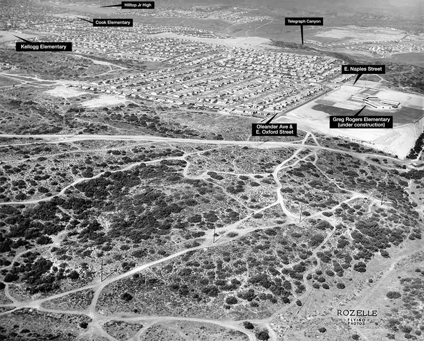
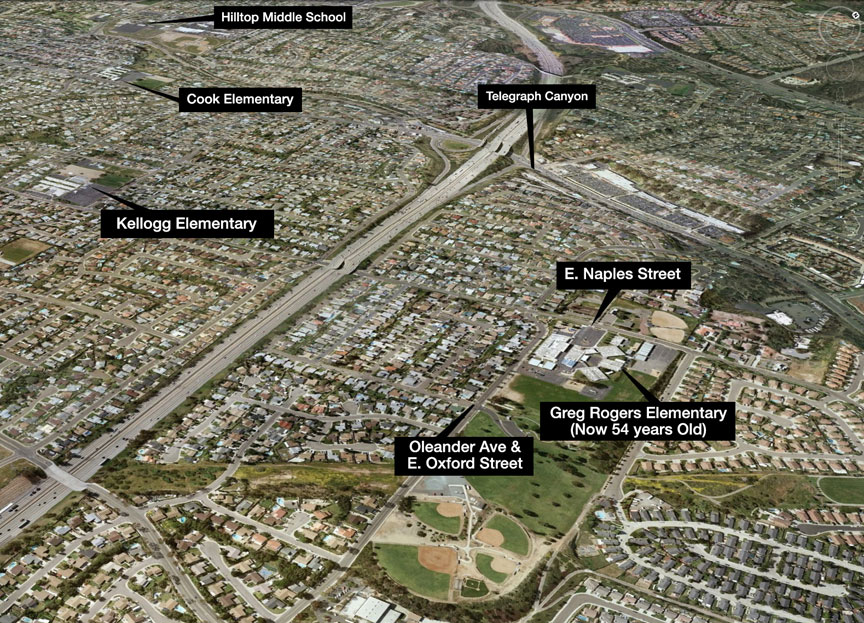
A
number of years back I might have opined
regarding Brenda Hawes Wilson's belief that
the aerial photo shown as "Terra Incognita"
(see below) was Pershing Jr High (which I
attended '67-'69). I knew that school shown on
the right side of that Rozelle image couldn't
have been Pershing mainly because in 1960,
Pershing Jr High was 4 years away from
existing. Nonetheless, I couldn't identify the
area, so I figured I should shut up if I
couldn't put up. I saw that mystery
photo again recently and I was determined to
locate that neighborhood using Google Earth. I
had an feeling it wasn't north of the 94, so I
decided I would scan the South Bay regions of
Chula Vista, National City, Logan Heights and
Encanto starting at the Mexican border and go
north. Within a few virtual passes over Chula
Vista, I spotted a school that fit the
footprint of the school in Rozelle's Aerial
photo. It appears to be Greg Rogers Elementary
on East Naples Street under construction.
After enlarging your image and studying the
layout of the neighborhood to the left of the
school, I am 99.9% sure this aerial photo was
a shot of the Easternmost Chula Vista
community south of Telegraph Canyon. I'll let
you be the judge -- Tim
Arnold ’74 (June 24, 2016)
|
|
|
 |
|
|
I
got no clue on this Rozelle aerial
Howard has written 10-27-60 on the back if
that helps.
I
believe this photo is the Lake Murray
area, where I lived and went to school.
Pershing Junior High School is on the
right side of the picture and the road is
70th street before they paved it. It is
also near my street Campus Dr. So if you
look at it carefully you can see my house.
It is in the middle of the picture. I can
see the school and my house is about 3
blocks from there – Brenda
Hawes Wilson ‘69
|
|
|
|
|
|
|
|