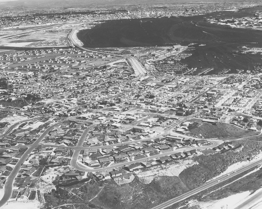
| NO
MYSTERY HERE, and Howard even put a date on
the back -- March 1957. I assume that's a
newly-completed Nimitz Boulevard in the
foreground looking southeast to San Diego
where the El Cortez hotel can be seen among
the other notable edifices. I'm always
fascinated that each Rozelle aerial has a
special memory for someone. I wonder what this
one will be.
I
would like to correct you on this photo
titled "Loma Portal". It should be named
"Fleetridge" as this is the neighborhood in
the forefront with Roseville above it with
the original Point Loma Little League field
(triangle shape) at the near top, center
bounded by Nimitz Blvd. to the left and
Harbor Drive on the right. The street that
borders the bottom of the photo is Canon
Street. It was part of 5 mile race course
that Barney Oldfield participated in
sometime in 1915. The memory I have with
this photo is that the dirt path at the very
bottom right of the photo, parallel to Canon
St., is actually about the mid-point of a
large storm drain pipe that begins near the
top of Talbot St. and empties over a mile
away into the Shelter Island yacht basin
next to the SD Yacht Club -- or at least it
did in 1960 when you could ride a Flexie
down it! -- Best
Regards, Don Szalay, PLHS '68
|
|
|