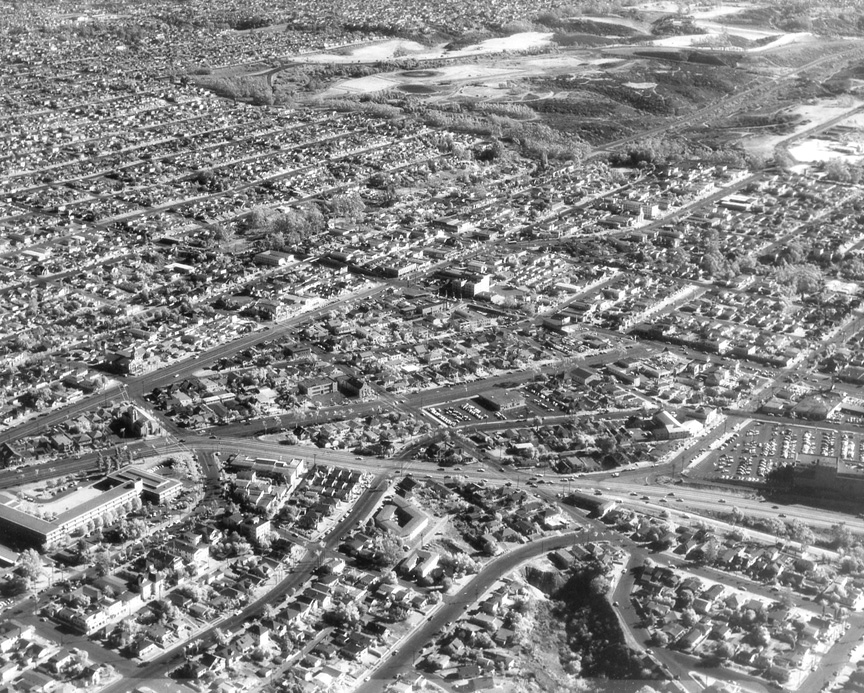
| THIS HOWARD ROZELLE MYSTERY
PHOTO was taken on November 15, 1960, but
that's all I know. I'm wondering if it was
even taken in the United States, but I don't
think Howard ever took any aerials in Mexico.
Enjoy.
How could you miss Balboa
Park? That's the old Sears parking lot on
the right, and the Education Center (where
my dad worked) is on the left. Washington
St. is in the foreground, as it curves
around to join Normal St -- Mike Fry ’60
This one is fairly easy. The view is
southeast. The shadow on the right side
falls on the old Sears store in Hillcrest.
The intersection in the middle of the
picture is University and Park Ave. Below
that and a little to the right is the DMV --
a lot of us should remember it. I believe
the large building in the lower left was the
Board of Education -- Ed Miller ‘62
The photo is easier than we think. The photo
was taken looking south and it was just
above 395 at the top of Hillcrest. The
building on the lower left is the Ed Center.
The parking lot for the old Sears
(Hillcrest) is on the middle right. The
concrete road going from the Ed Center
across the lower portion of the photo is
Washington, which I suspect was cut through
from El Cajon Blvd. and Park Blvd. to
Pacific Highway at the beginning of WW II to
transport workers from the North Park area
directly down to the Convair Plants 1 and 2
At the top of the photo is Balboa Park, and
Park Blvd. is the straight street from just
above the Ed Center to the upper right
towards Balboa Park (and then it makes a jag
to the right and becomes that thin road at
the upper right of the photo. Love these
puzzles, but where do you post the answers?
-- Earl Feldman '61
Jeez, Louise -- I think some
of you folks are the ones who tried to
convince me that algebra was "easy" at
Horace Mann. Everything is "easy" if you get
it. I'm not buying that you can see Balboa
Park, although I'll concede that you're
technically correct if you include Morley
Field and the Municipal Golf Course. Earl,
the answers are right here -- and "here"
will be a link below in the very near
future.
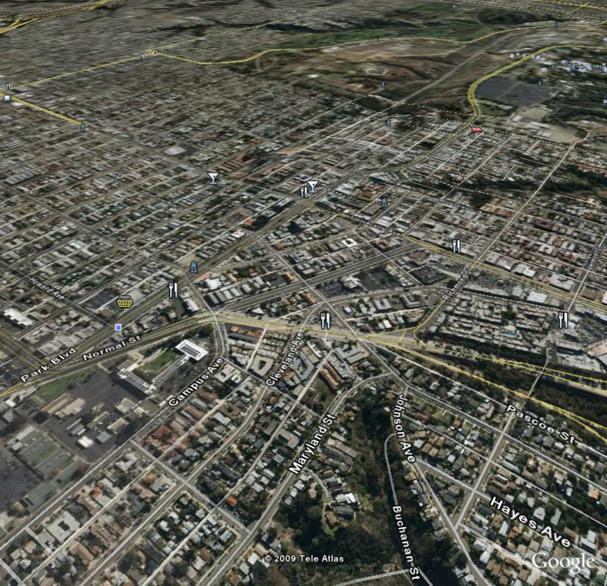
Google map below courtesy
of Earl Asbury '64
|
|
|