|
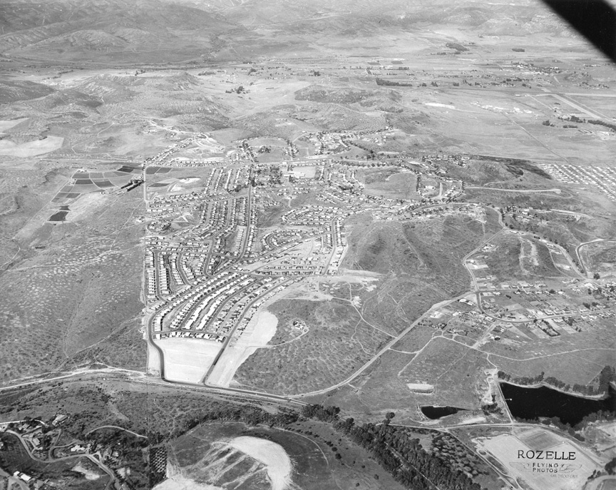
There's no date on this
Rozelle aerial, so you're on your own. I
guess the reservoir at the right would be a
clue.
Is that not an airport in
the upper right-hand corner? Looks Like
Gillespie Field, to me. I think it is the
reservoir that is under Harry Griffin Park.
That looks like Severin Drive to the middle
left. I lived on one of those streets when I
was a kid. I don't see Northmont Elementary.
Northmont was built around 1957, according
to their website. It must have been new when
I went there in 1958. I would give almost
ANYTHING to see to the lower right a tad, to
see if Grossmont High School is hiding in
there. Be interesting to see if I'm correct
about THIS one -- Alan Fedder ‘69
I was just about to give up
on Rozelle #33 but then stumbled on the
solution: the view is north, with Amaya
Drive passing left-right in lower portion.
Severin Drive takes off north of it on the
left. The reservoir is about where my
map.google map shows Grossmont Reservoir,
but the satellite image doesn't show any
sort of reservoir there any longer, but the
area is part of what is now Harry Griffin
Park. In the upper right might be an early
version of Gillespie Field, but I'm not
sure. Fletcher Parkway hasn't been built
yet. Hey, these are getting harder -- Bob
Richardson '61
|