|
|
|
 |
|
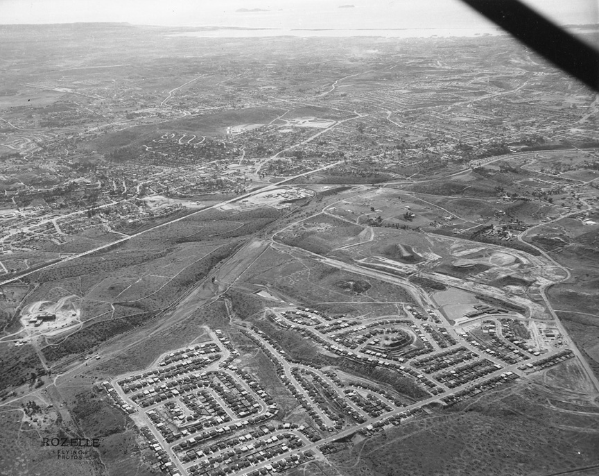
I'M
NOT SURE I WOULD HAVE figured this one out if
Howard hadn't written the answer on the back.
Clues to what direction you're facing are at
the top of the photo.
It's
that other picture from the other week, but
from another angle. (I
think Alan's talking about #45 --
JF)
It's Dallas! From the North. What was that
subdivision called? Is that Grossmont Hospital
being built over there? It opened around 1955.
Not much of Fletcher Parkway in evidence, but
Jackson Drive and Murray Manor Elementary are
there -- Alan
Fedder '69
I'm fairly sure we are looking southwest at
the north La Mesa area south of San Carlos
near Fletcher Hills. The bottom-most street is
Dallas Street bordered by Jackson Dr and the
gully, which would become Fletcher Parkway.
That "Y" street configuration in the
foreground looks like the convergence of Nagel
and Santa Streets. Is that the beginnings of
Grossmont Hospital on the far left? -- Rodger
Gredvig, '64
This picture sure gives us a different
prospective -- La Mesa looking from the
northeast. The road in the foreground is
Dallas, which intersects with Lake Murray
Blvd. On the left side of the picture we can
see Grossmont High School and Highway 80,
which connected to El Cajon Blvd (US 80) and
Alvarado Canyon Rd. I figure the picture dates
from the early ‘50s --
Ed Miller 62
|
|
|
|
|
|
|
|